I found this gadget the other day and thought I should figure out how to use it. That way I can impersonate a real sailor.
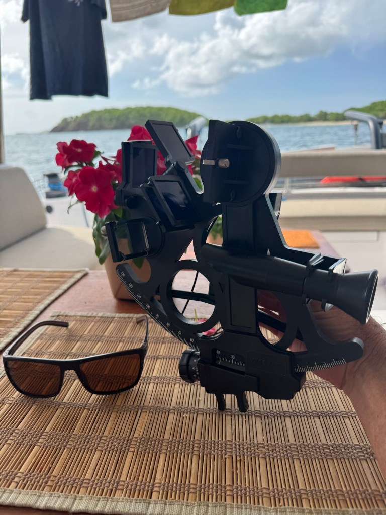
The device is used to measure the angle between the horizon and a heavenly body….sun, moon, other planets or a star. It is used for celestial navigation.
It was invented around 1730, think about that, almost 200 years ago, by some very smart and clever people, John Hadley and Thomas Godfrey.
Well I dusted it off, inserted the eye pieces, cleaned the mirrors and downloaded the operators manual.
The manual was a good read, if you want more details. Davis instrument sextant mark 15, and you can google the manual.
After aligning the mirrors I was very keen to measure the angle to the sun. I did this but didn’t really know what to do with this information, so more reading.
First, let’s put on our longitude hats. I’ll try to explain how longitude is calculated. These are the vertical lines running from pole to pole. The earth rotates once a day, so that’s 360 degrees in 24 hours. This works out to 15 degrees/hour.
Therefore if your clocks are 3 hours behind GMT, you’re on the 45 longitude west. ( 3hrs. x 15degrees/hr.) and 4 hrs behind GMT would be the 60 longitude west. Etc.
Now, if we want more accuracy than +or- 15 degrees we need more accuracy in our time measurement.
With our very precise sextant we can measure exactly when the sun is at its highest point, and record the time this happens. This is solar noon.
say 12:15 for example.
This 12:15 is local time.
GMT time is 16:15 say.
Now we know it was 4 hours, 15 minutes from sun above the prime meridian to the sun being at its highest point above us at our location.
We don’t know when the sun was at its highest point over the Prime meridian, around 12:00 GMT, but not exactly, it could have been + or – 30 minutes or more. With a table we can look up the “equation of time“ for the given day, and this will give us an offset value in degrees and minutes to be added or subtracted from our calculation.
So, if we take the GMT time of solar noon at our location, 16:15, then minus the 12:00 for solar noon at Prime meridian, we get 4:15 or 4.25 hours difference.
4.25 hours x 15 degrees/hour = 63.75 degrees.
Then looking at our handy reference table we see on this day the “equation of time” is 1 degree east, therefore we would be on the 62.75 meridian. This equals 62degrees, 45 minutes as each degree is made up of 60 minutes.
That was fun, now if you’re still awake let’s put on our latitude hats. Latitude’s run parallel to the equator.
The maximum angle to the sun from the horizon is related to your latitude. If the earth didn’t have this crazy 23.5 degree tilt, we could just measure the maximum angle to the sun and be done. It would be 90 degrees on the equator. On the tenth latitude the sun would peak at 80 degrees above the horizon.
Because of this 23.5 degree tilt we have to add or minus a declination value to our reading.
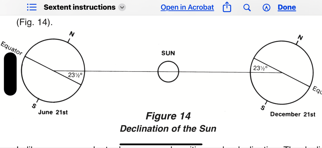
This isn’t hard you simply look it up in the reference table. It varies from +23.5 to -23.5 over the year.
Other things you factor in are the height of your eye above the ground, did you measure to top or bottom of the sun, and any errors in your sextant. If the sun angle is less then 25 degrees above the horizon then the refraction from earth’s atmosphere is another factor.
The above is a good method to determine your position but has to be done around noon.
I bought a $3.00 app, can enter my sighting, press a button on my phone to record the GMT, and it will draw a line that I’m on.
If I take another reading a few hours later, or at the same time to a different heavenly body, these lines will cross at my location. 😀.
